

| App Name | Zoom Earth |
| Developer | Neave Interactive |
| Category | Weather |
| Size | 28.5 MB |
| Latest Version | 3.1 |
| Available on |


Zoom Earth is your go-to interactive weather map for tracking hurricanes, typhoons, and tropical cyclones in real-time. This comprehensive platform not only offers real-time hurricane tracking but also a suite of features designed to keep you informed and prepared for any weather event.
Key Features
Satellite Imagery: Zoom Earth provides weather maps with near real-time satellite imagery sourced from top agencies like NOAA GOES, JMA Himawari, EUMETSAT Meteosat, and NASA's polar-orbiting satellites Aqua and Terra. This ensures you have the most current view of weather patterns around the globe.
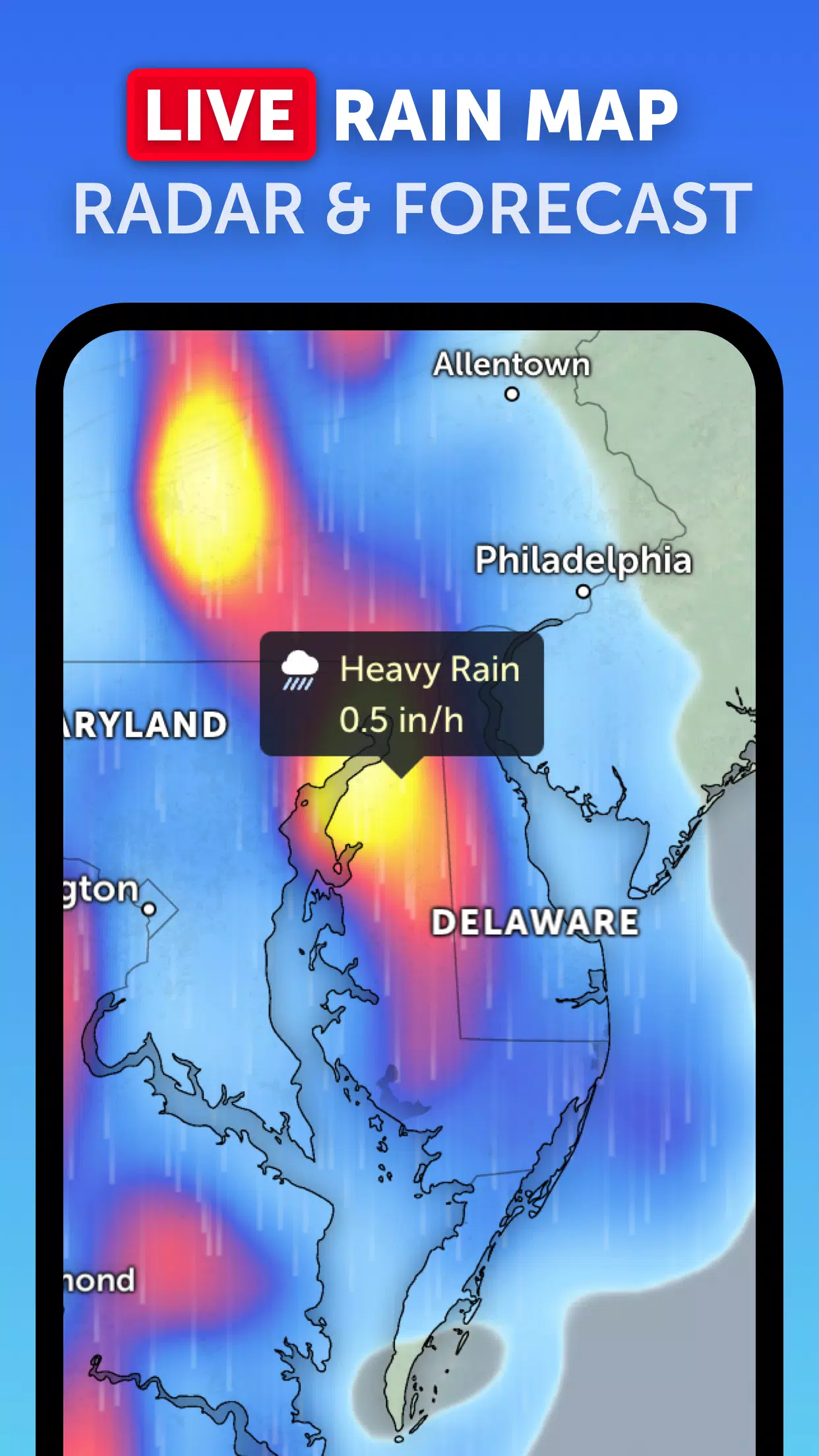
Rain Radar: Stay one step ahead of the storm with our detailed weather radar map, which displays real-time rain and snow detection using ground-based Doppler radar. This feature is crucial for monitoring the progression of tropical systems as they approach land.
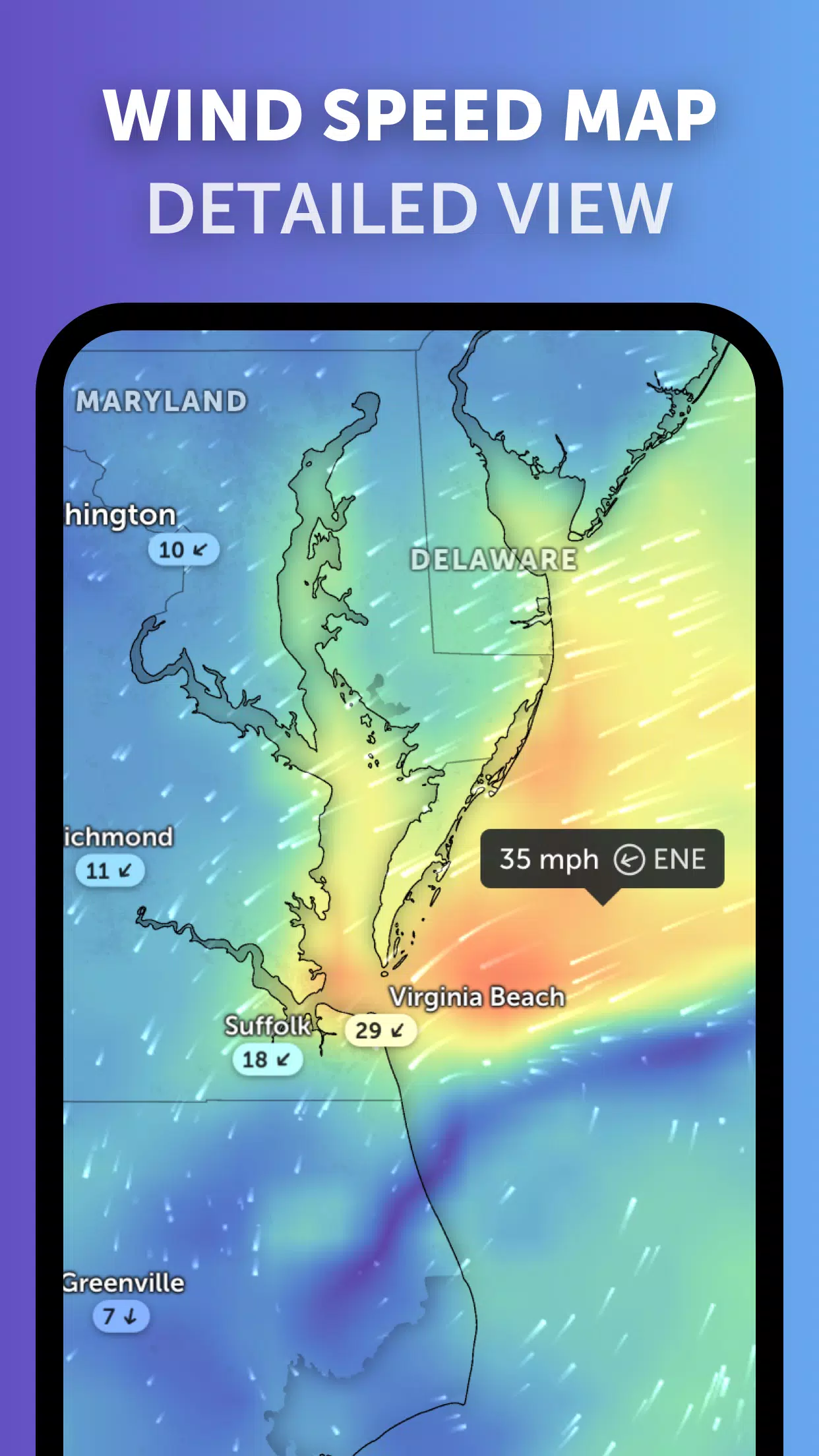
Weather Forecast Maps: Dive into beautifully crafted, interactive visualizations of global weather forecasts. Our maps cover a wide range of data points, including precipitation, wind speed and gusts, temperature, "feels like" temperature, relative humidity, dew point, and atmospheric pressure forecasts. These are essential for understanding the potential impact of hurricanes and other tropical cyclones.
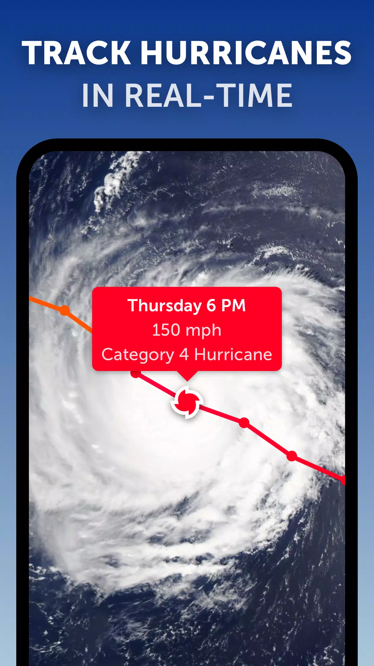
Hurricane Tracking: With Zoom Earth, you can follow the lifecycle of hurricanes from their initial development to their peak as Category 5 storms in real-time. Our system leverages the latest data from the National Hurricane Center (NHC), Joint Typhoon Warning Center (JTWC), Naval Research Laboratory (NRL), and International Best Track Archive for Climate Stewardship (IBTrACS), ensuring you have accurate and up-to-date information.
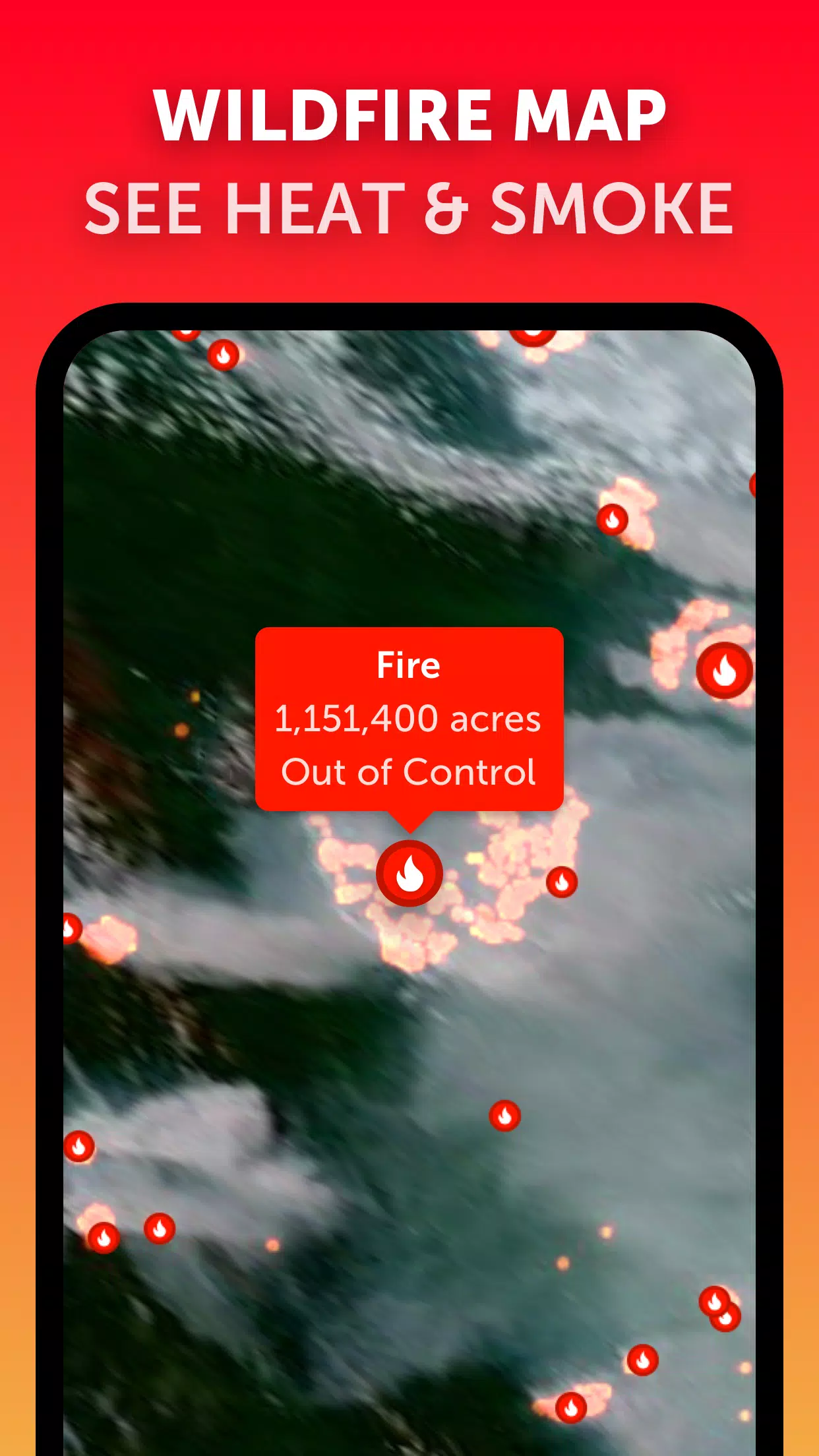
Wildfire Tracking: In addition to tropical systems, Zoom Earth allows you to monitor wildfires through an active fires and heat spots overlay. This feature uses daily updates from NASA's Fire Information for Resource Management System (FIRMS) to show points of very high temperature detected by satellite, which is particularly useful during hurricane season when fires can be exacerbated by storm conditions.
Customization: Tailor your experience with Zoom Earth by adjusting temperature units, wind units, time zone, animation styles, and more through our comprehensive settings. This personalization ensures that you get the most relevant information for your location and preferences.
What's New in the Latest Version 3.1
Last updated on Sep 19, 2024
- Reduced Clutter: We've streamlined the display when viewing multiple tropical systems, making it easier to focus on specific storms.
- Separate Alerts: Now you can receive distinct alerts for Atlantic and Eastern Pacific systems, enhancing your ability to track and prepare for regional weather events.
- Improved Map Labels: We've enhanced the clarity and readability of map labels, ensuring you can quickly interpret the data presented.
With these updates and features, Zoom Earth remains the premier choice for tracking hurricanes, typhoons, and tropical cyclones in real-time, providing you with the tools you need to stay safe and informed.
-
 Trainer's Pokémon Set to Resurface in Pokémon TCG in 2025
-
 Clash of Clans Unveils Town Hall 17: Game-Changing Update Released
-
 Stalker 2: List Of All The Artifacts & How To Get Them
-
 Mastering Parry Techniques in Avowed: A Guide
-
 Shadow of the Depth: Open Beta Now Available on Android
-
 Breaking: Ubisoft Unveils Covert NFT Gaming Venture