
Home > Apps > Maps & Navigation > USA GPS Maps & My Navigation

| App Name | USA GPS Maps & My Navigation |
| Developer | Navegante Maps |
| Category | Maps & Navigation |
| Size | 5.4 MB |
| Latest Version | 4.03 |
| Available on |


With over 2 million downloads, our All in One GPS Map App is the fastest and easiest way to navigate the world. Whether you're exploring all cities and streets globally, this app is your ultimate travel companion. From taxi drivers to tourists, pedestrians to couriers, everyone on the move can benefit from its comprehensive features: GPS, Maps, Location, Geodir, Save, Share, Navigation, Direction, and Compass.
For the best routing experience, we recommend using the app outdoors. Your safety is our priority; rest assured, no data is collected or shared with any third party. For more details, please visit our Privacy Policy page.
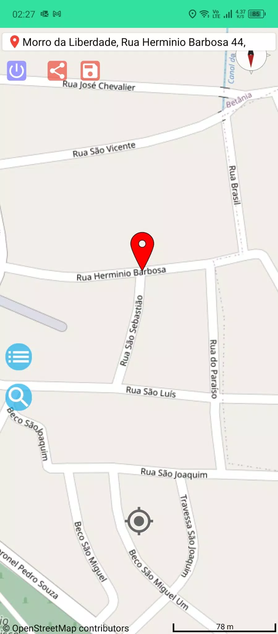
Discover what's nearby, including bus stops, subway stations, trains, restaurants, cafes, hotels, hospitals, police stations, shops, and schools. Our app lets you search, save, and send locations effortlessly, all in your own language. It's faster now, quickly finding, recognizing, and displaying all global addresses on the map.
Experience seamless driving and pedestrian navigation with instant current street addresses and zip codes. Our precise live GPS location, along with compass orientation, ensures you're always on the right path. The map dynamically rotates around the compass for intuitive navigation. With offline map settings, you can explore even without an internet connection. Walk the streets in high definition using our Street View plugin.
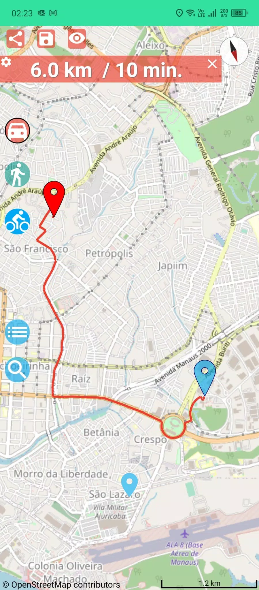
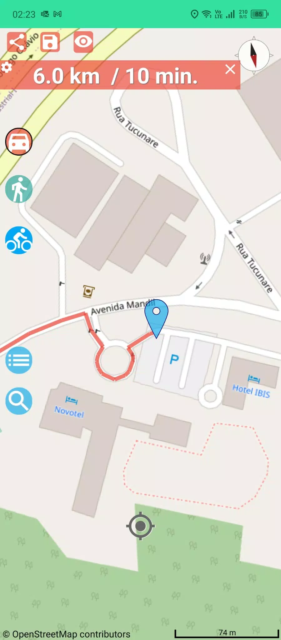
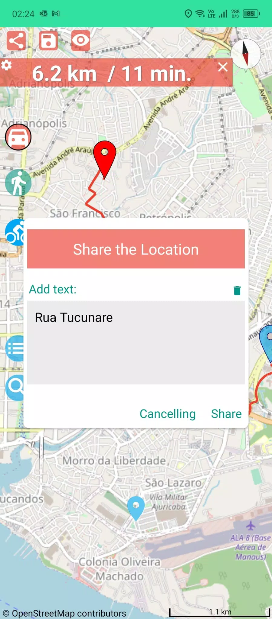
Find directions on foot, by public transport (bus, metro, train, ferry, etc.), or by car. The app calculates the shortest route to your destination, showing time and distance, which can be set in kilometers or miles. Keep recently searched addresses in the cache for quick access, and easily save and share places. You can even speak and search directly on the map.
Share your real-time online position on the map and add a photo or screenshot to your location share. Use the Streetview feature to check your target point. Different colored travel routes help distinguish between pedestrian and driver paths. For precise results, include the city in your searches, like "Wall Street, New York."
Our app is one of the least space-consuming and minimal cache apps on the Android platform, downloading quickly and taking up minimal device memory. It's the fastest way to travel around, offering a simple user experience compared to more complex GPS Map apps on the market.
We're continuously improving, with cyclist trip routes and weather forecasts on the way. Your feedback is invaluable—please share your suggestions and contributions with us.
-
WanderlustJenNov 26,25As a frequent traveler, this app has been really helpful for navigating unfamiliar cities. The interface is clean and directions are generally accurate, though it occasionally lags when recalculating routes 🗺️. Overall a solid 4-star experience!iPhone 13
-
 Trainer's Pokémon Set to Resurface in Pokémon TCG in 2025
-
 Clash of Clans Unveils Town Hall 17: Game-Changing Update Released
-
 Stalker 2: List Of All The Artifacts & How To Get Them
-
 Mastering Parry Techniques in Avowed: A Guide
-
 Shadow of the Depth: Open Beta Now Available on Android
-
 Breaking: Ubisoft Unveils Covert NFT Gaming Venture