
Home > Apps > Maps & Navigation > Navitel Navigator GPS & Maps

Navitel Navigator GPS & Maps
May 06,2025
| App Name | Navitel Navigator GPS & Maps |
| Developer | NAVITEL |
| Category | Maps & Navigation |
| Size | 95.8 MB |
| Latest Version | v11.11.1075 |
| Available on |
3.5


Navitel Navigator 11 is your go-to solution for precise offline GPS navigation, complete with up-to-date online services and incredibly detailed maps covering 67 countries and territories worldwide. Enjoy a 7-day free trial to experience the difference.
ADVANTAGES
- Modern User-Friendly Interface: Navigate with ease using a sleek and intuitive design.
- Offline Maps: No internet required for map usage, saving you from roaming charges and ensuring reliable navigation regardless of connectivity in various regions.
- Highly Detailed Navigation Maps: Explore with confidence using maps that offer a high level of detail.
- Voice Search: Effortlessly find your destination using voice commands.
- Easy POI Search: Quickly locate Points of Interest by category for convenience on the go.
- Visual and Voice Guidance: Follow your route with clear visual and voice directions.
- Real-Time Road Information: Stay informed about road warnings, dangerous spots, speed cameras, and road restrictions.
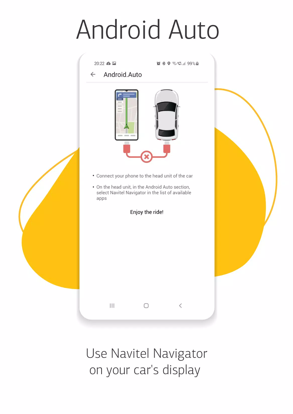
- HUD (Head-Up Display): Project navigation onto your windshield for safer driving.
- Extensive Coverage: Purchase detailed navigation maps for 67 countries and territories around the globe.
SPECIAL FEATURES
- Fast Route Calculation: Instantly compute and route any journey, no matter the length or complexity.
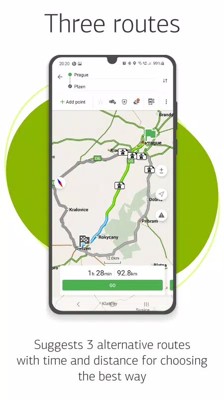
- Alternative Routes: Choose from three different routes, complete with distance and travel time estimates.
- Navitel.Traffic: Real-time traffic jam information to help you avoid delays.
- Navitel.Events: Stay updated with user-reported road accidents, construction zones, speed cameras, and other events.
- SpeedCam Warnings: Get alerts for radars, video recording cameras, and speed bumps.
- 3D Mapping: Navigate using three-dimensional maps with detailed textures and multiple floors.
- 3D Road Interchanges: Visualize complex road interchanges in 3D for better route understanding.
- Lane Assist: Receive route guidance tailored for multilane traffic, complete with visual cues.
- Turn-by-Turn Voice Guidance: Enjoy continuous voice directions while following your route.
- Cargo Graph: Plan routes for vehicles from 3.5 to 20 tons, customizing to your vehicle's specifications.
- Dynamic POI: Access real-time information like fuel prices and movie showtimes.
- Unlimited Waypoints: Plan complex journeys with an unlimited number of stops along the way.
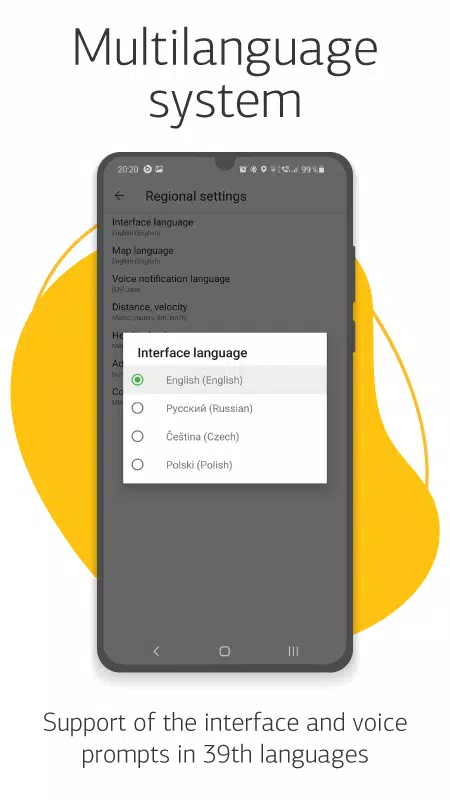
- Multilanguage Support: Interface and voice prompts available in 39 languages.
- Customizable User Interface: Tailor the program's interface and map display to your preferences.
- In-App Purchases: Easily buy new map packs or renew existing ones directly from the menu.
- Multitouch Support: Use gestures for quick map scaling and rotation.
- Dual Navigation System Support: Utilize both GLONASS and GPS for enhanced accuracy.
For any questions or assistance, reach out to us at [email protected]. We're here to help you navigate your world!
Post Comments
Top Download
Top News
-
 Trainer's Pokémon Set to Resurface in Pokémon TCG in 2025
-
 Clash of Clans Unveils Town Hall 17: Game-Changing Update Released
-
 Stalker 2: List Of All The Artifacts & How To Get Them
-
 Mastering Parry Techniques in Avowed: A Guide
-
 Shadow of the Depth: Open Beta Now Available on Android
-
 Breaking: Ubisoft Unveils Covert NFT Gaming Venture