
Home > Apps > Maps & Navigation > All-In-One Offline Maps

| App Name | All-In-One Offline Maps |
| Developer | Psyberia |
| Category | Maps & Navigation |
| Size | 7.2 MB |
| Latest Version | 3.15d |
| Available on |


OfflineMaps provides you with a comprehensive suite of mapping options, ensuring you have access to a wide range of maps without any interruptions or privacy concerns.
No advertisements ~ No data sharing & monetization ~ No analytics ~ No third party libraries
Tired of waiting for maps to load? With All-In-One OfflineMaps, once you've viewed a map, it's stored and remains accessible, even without an internet connection.
• Want more than just road maps? We've got you covered with everything you need;
• Heading to areas with poor network coverage? No worries, all maps stay available;
• Traveling abroad? Never get lost again;
• Concerned about data limits? Our app will help reduce your data usage.
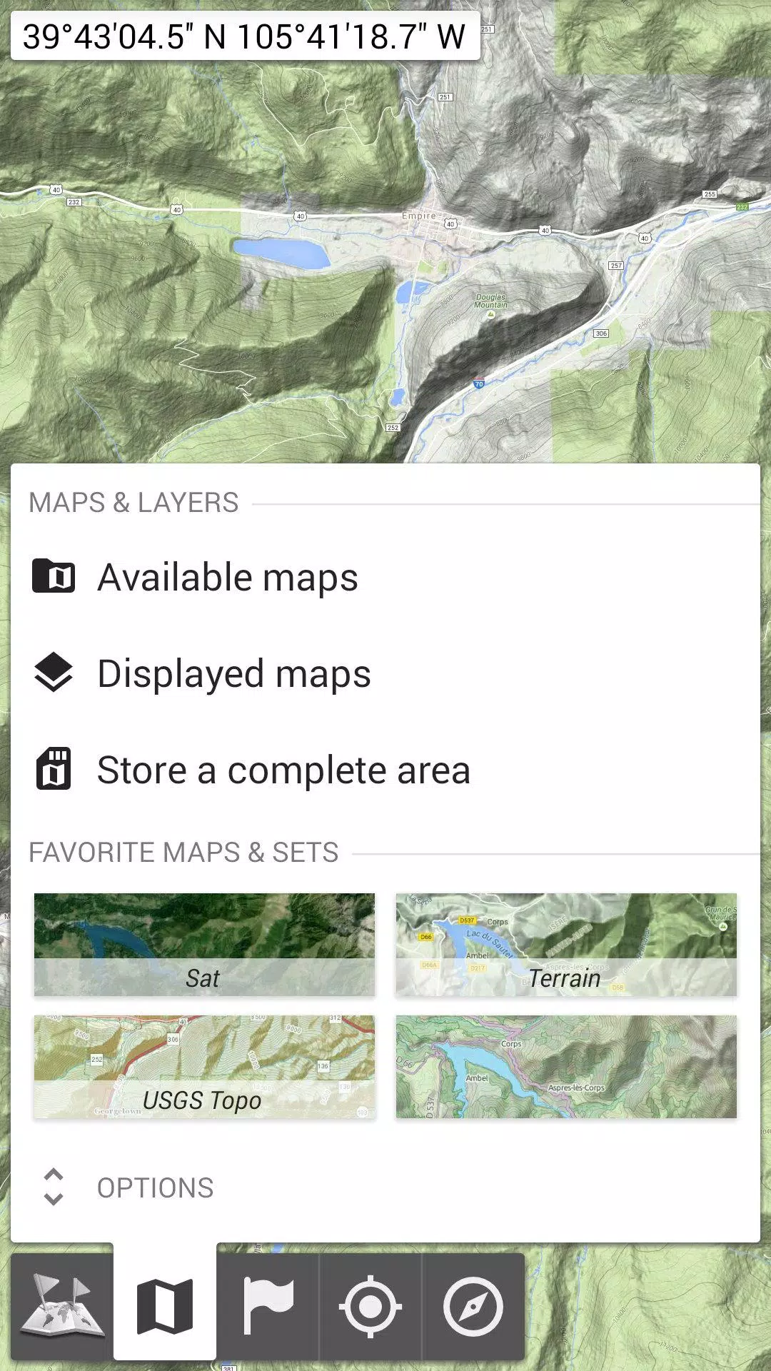
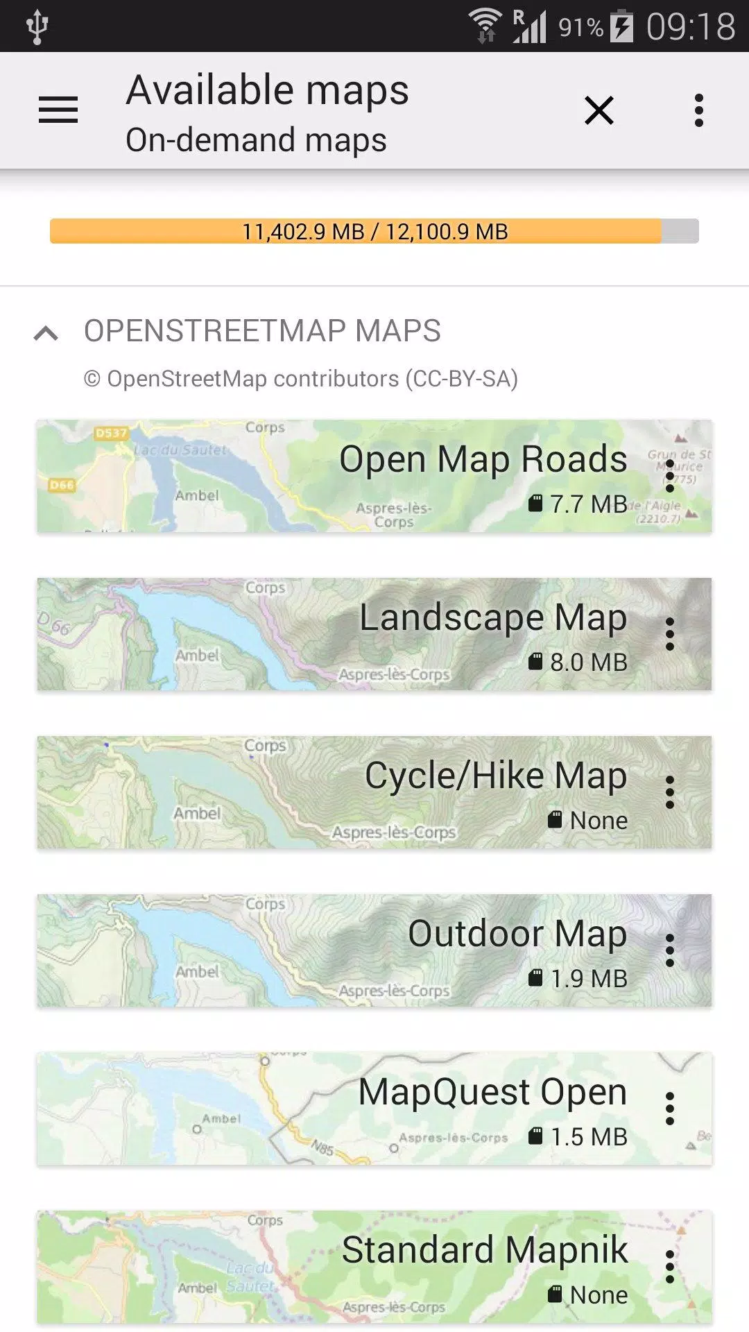
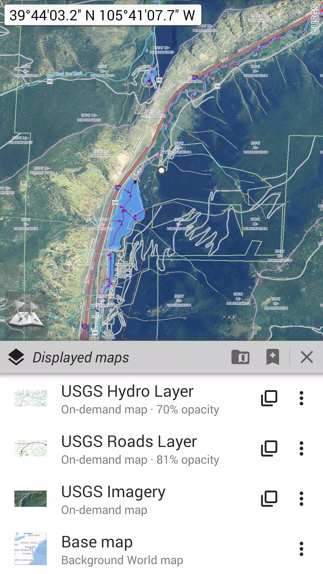
★★ Maps ★★
Explore a variety of maps, including classic road maps, topographic maps, aerial (satellite) maps, and numerous layers that can be added to any map: OpenStreetMap (Roads, Topo), USGS National Map (Hi-res topo, Aerial imagery), Worldwide Military Soviet topo maps, and more.
• Layer multiple maps with adjustable opacity;
• Easily select and store large areas with just a few clicks;
• Manage your stored map data effortlessly, with clear and easy deletion options.
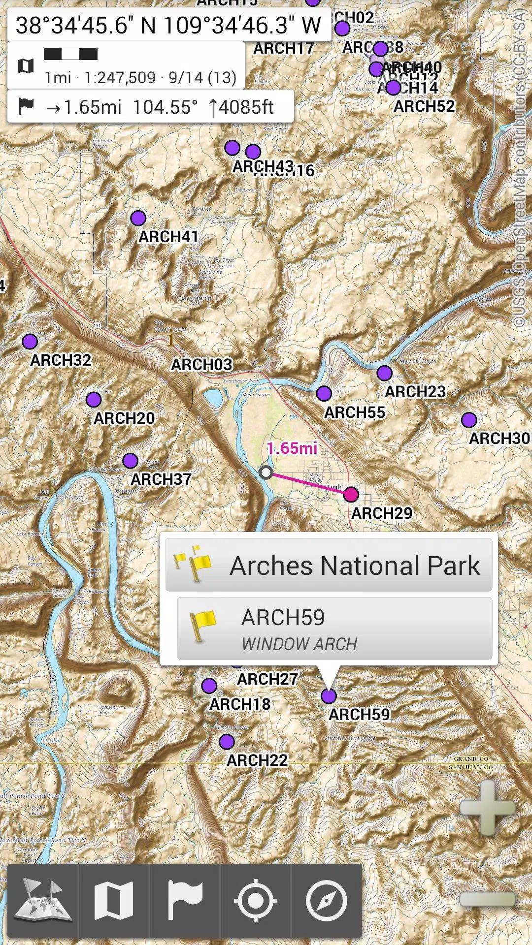
★★ Display, Store, and Retrieve Unlimited Placemarks ★★
Add various items to your maps, such as waypoints, icons, routes, areas, and tracks.
Effortlessly manage these items using our robust SD-Card Placemarks Explorer.
★★ On-Map GPS Location & Orientation ★★
See your real-time location and direction clearly displayed on the map, which can be rotated to align with your actual orientation (device capabilities permitting).
Easily toggle this feature on and off to conserve battery life.
Additionally:
• Choose from metric, imperial, and hybrid distance units;
• Utilize various GPS coordinate formats including Latitude/Longitude and grid systems (UTM, MGRS, USNG, OSGB Grid, Irish Grid, Swiss Grid, Lambert Grids, DFCI Grid, QTH Maidenhead Locator System, and more);
• Import hundreds of coordinate formats from https://www.spatialreference.org;
• Display on-map grids;
• Enjoy full-screen map views;
• Use multi-touch zoom;
• And much more!
★★ Need More? ★★
For avid adventurers, consider AlpineQuest Off-Road Explorer, the ultimate outdoor solution built on All-In-One OfflineMaps, featuring a robust GPS Track Recorder and additional functionalities: https://www.alpinequest.net/google-play
-
 Trainer's Pokémon Set to Resurface in Pokémon TCG in 2025
-
 Clash of Clans Unveils Town Hall 17: Game-Changing Update Released
-
 Stalker 2: List Of All The Artifacts & How To Get Them
-
 Mastering Parry Techniques in Avowed: A Guide
-
 Shadow of the Depth: Open Beta Now Available on Android
-
 Breaking: Ubisoft Unveils Covert NFT Gaming Venture